200 Years Since the Introduction of the Franciscean Cadastre
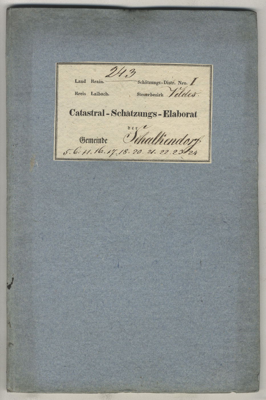
Evaluation study of the cadastral municipality of Bled. | Author Arhiv Republike Slovenije
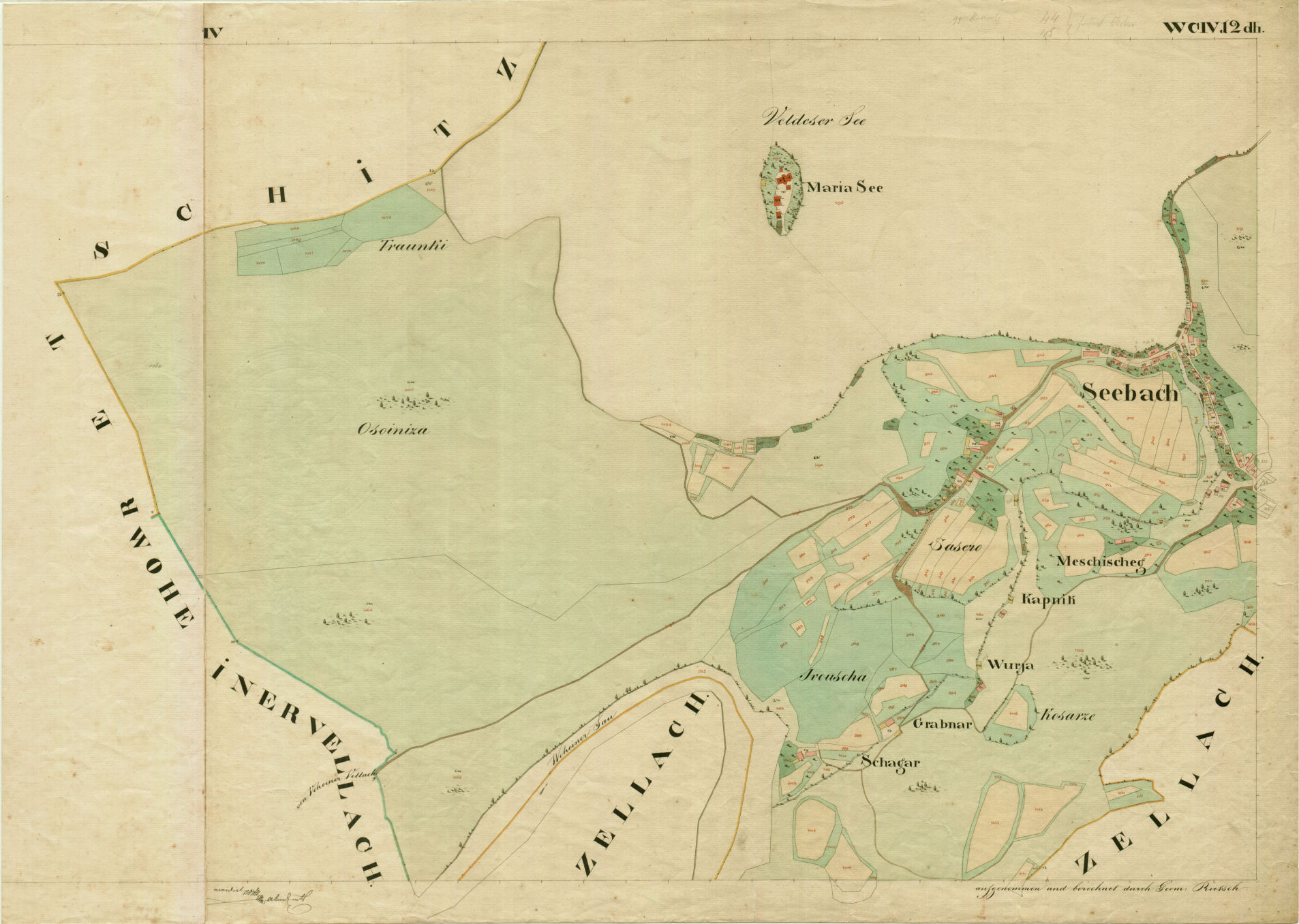
Franciscan cadastre map for Bled Island. | Author Arhiv Republike Slovenije
In 2017, we are commemorating some important historical milestones whose impact changed the course of our country’s history. In the spring, we celebrated the 300th anniversary of the birth of Maria Theresia, and on December 23 another such important anniversary is taking place. On that exact day, 200 years ago, the Austrian Emperor Franz I signed the Land Tax Act (Grundsteuerpatent) and ordered the compilation of the Franciscean cadastre. Records created at that time and for that particular purpose are, of course, regarded as archives and as a European cultural monument, since they were the first of this kind in the whole of Europe.
Franciscean cadastre was compiled after the Napoleonic Wars, which devastated and impoverished Europe and its still very much feudal economy. In the 1820s, after the war-stricken states started to heal economically and there was a continuing increase in crop yields, a need for tax and administrative reforms in the Habsburg Monarchy became more and more apparent. Although the majority of the monarchy’s taxes were collected from agriculture and land cultivation, its state apparatus was still based on the old pre-March Revolution laws and regulations.
Today, Franciscean cadastral records are an important reference material for scientific research in various fields of science. Although primarily examined by historians, ethnologists, geographers and geodesists, such material can be a valuable source of information for many other scientific disciplines as well.
Apart from the actual maps, the cadastre also includes a number of other important types of documents, such as descriptions of the borders of cadastral communities, a register of land plots and building plots, and an alphabetical list of the land plots owners within each cadastral community. The compilation of the Franciscean cadastre was the first systematic land survey conducted in politically, economically and culturally very diverse Austrian lands of the Habsburg Monarchy. It was conducted following the pre-defined methodology and standards which allowed little or no interference from land owners. There were also notes accompanying the main body of the cadastre which provide insight into the lives of the population. Especially insightful are cadastral valuation reports (Catastral-Schätzungs-Elaborat) which included detailed descriptions of individual cadastral communities, their topographic features, population, livestock, road connections, water, land cultivation, rotation of crops, potential industrial or artisan workshops, and even the number of the buildings in each community that were insured against fire. The second part of such valuation report provided a detailed explanation of the methodology to estimate income for taxation based on the quality and yield of an individual land plot.
Apart from the above mentioned types of data, the report also included information on historical monuments and sights in each cadastral community. When referring to the lake and the island of Bled, which today are among the most recognized Slovenian tourist destinations, cadastral data stated that the area measured 254 acres and 1009 square fathoms. Located in the somewhat western part of the lake was an island with a beautiful church, a vicarage and a verger’s house, all of which belonged to the state seigniory of Bled. The eastern part of the lake had some hot springs and there was a bathing facility with four baths of warm water built there already in the first half of the 19th century. Nearby was another facility with three baths that contained cold water.
At the time when the cadastre was being compiled, there was a “story” circulating among the older farmers in the surrounding area of Bled about a pagan temple standing in Bled (presumably on the island), where people went to worship the Slavic idol (god) Rastigost. To provide easier access to the temple, a wooden bridge was believed to have been constructed, which could only be used by those who performed religious rituals (“God’s servants”) and those who brought gifts and sought advice. It is here that summer solstice was believed to have been celebrated by setting woodpile alight (bonfire) and by a night festivities with dancing and singing. Despite the fact that Bled Castle had been drawing much attention ever since the first half of the 19th century, the cadastral note about the castle above the lake is brief. The records only state that a special feature of this area is a castle standing on a 69 fathom high rock above the lake.
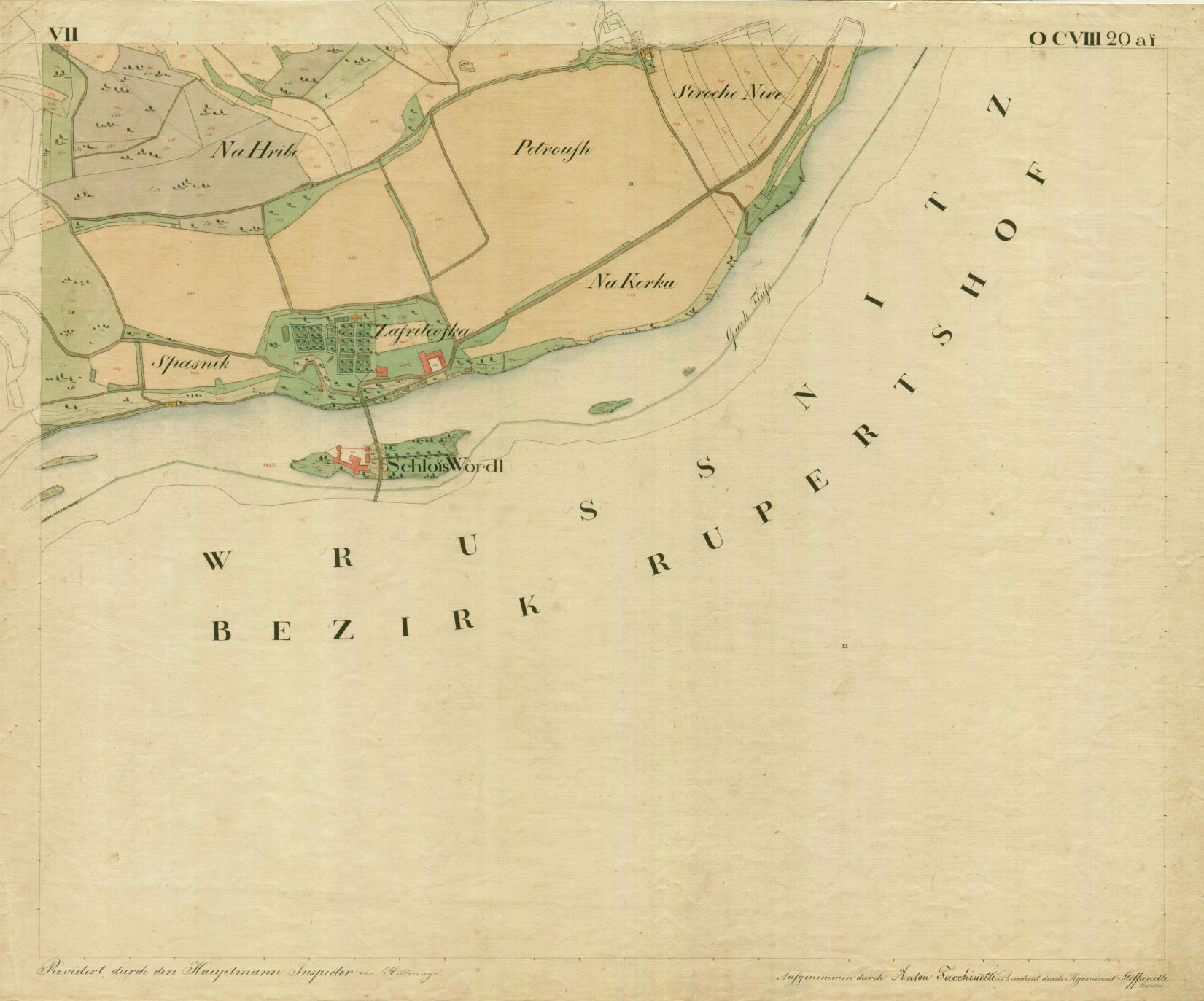
Also of interest to cadastral surveyors was Otočec Castle located on the island in the middle of the river of Krka. Even at the time of the compilation of the cadastre, the access to the island was made possible by bridges constructed from both river banks. During Turkish raids the river offered perfect protection for those who sought refuge in the castle.
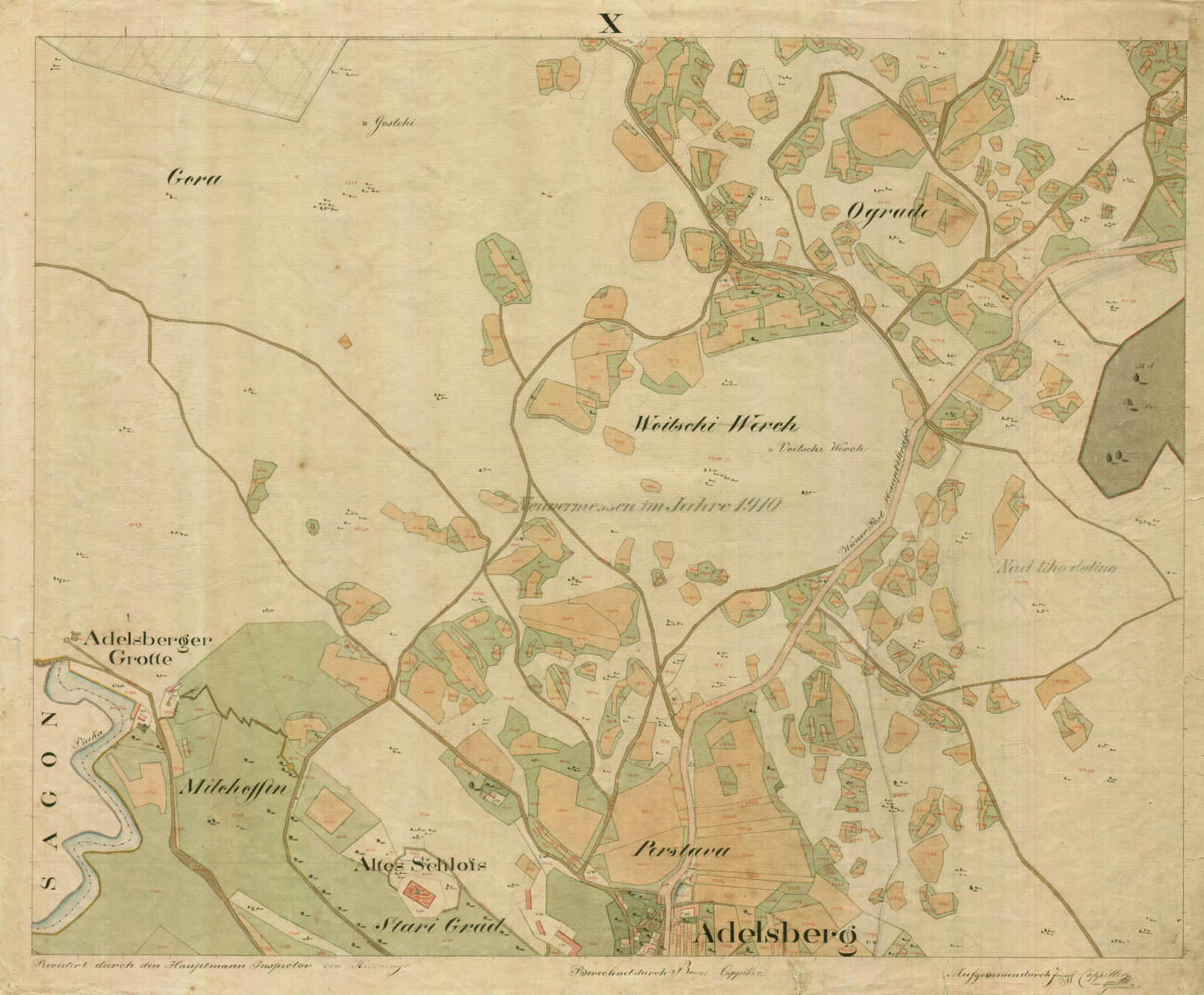
The local sight mentioned in the cadastral valuation repot for Postojna was the Postojna cave, which at the time the cadastral surveys were being made had already been discovered. It was described as one of the two caves located under the hill Sovič, on top of which one can still see the ruins of the old Postojna castle “with the imposing cathedral”. In the cave there were magnificent stalactites and stalagmites, some small and pretty and others so huge as to almost appear grotesque. One can take a two-hour walk along a well-kept path without destroying the objects found in the cave in the process. To offer the people a look at this magnificent underground masterpiece of Mother Nature, a Grottenfest or a celebration was organized annually on Whit Monday during which time the cave was brightly lit. On such occasions several hundred people visited the cave.
Since land cultivation and farming represented the main source of livelihood for everybody, it is understandable that these were the topics described in most details in such valuation reports. Special attention was often directed towards some of the more known, characteristic or quality local produces, for example to the wine produced on Trška Gora near Novo mesto. Artisan workshops, mines and industrial plants were another important source of tax money for the state treasury. Zois’ ironworks in Bohinjska Bistrica was described in cadastral records as being a plant with one smelting furnace, several fires for melting and ore processing, and 11 hearths for the making of nails. Most of the ore that was being processed was obtained from the local surrounding areas. They excavated about 12 500 cwt. of ore per year and the industrial plant itself employed around 400 workers, including those whose job was to make sure that there was always a sufficient amount of coal available for the ironworks. They produced around 4000 cwt. of nails and iron.
There are many more similar records to be found in the Franciscean cadastre and they all reveal what life was like for our ancestors. Despite the fact that Franciscean cadastral records are among the most frequently used documents in our archive’s search room, the wealth of information in these records, created almost 200 years ago, will never be fully exhausted.
Alenka Kačičnik Gabrič
