Green Slovenian Location Framework (GreenSLO4D)

Photo: Geodetska uprava
2021–2026

Author Surveying and Mapping Authority

Author Surveying and Mapping Authority
The project’s aim is to digitalize operations and bridge gaps between spatial and environmental politics with the result of an improved ecosystem for business and sustainable investment for an economy with increased value added.
The Green Slovenian Location Framework (GreenSLO4D) is a 48-million euro investment project, financed by the Recovery and Resilience Plan (33,5 million) and the Green Climate Fund (8,5 million).

Author Surveying and Mapping Authority
This project is planned in 3 phases from 2022 to 2026.

Author Surveying and Mapping Authority
Project Implementation
The Green Slovenian Location Framework (GreenSLO4D) for 2021–2026 is a Recovery and Resilience Plan (RPP) project run by the Survey and Mapping Authority of the Republic of Slovenia, the Ministry of Natural Resources and Spatial Planning, the Ministry of the Environment, Climate, and Energy, the Slovenian Environment Agency, and the Slovenian Water Agency.
Project Structure
Due to its scope, the project was broken up into 8 project groups: 2 horizontal groups and 6 vertical. Thus, the bodies comprising the project’s structural scheme also form the Project Council. The horizontal groups are the Geoinformation project group and the Project Office. The vertical groups include the Geodesy and Real Estate project team of the Surveying and Mapping Authority of the Republic of Slovenia, the Spatial project team of the Directorate for Spatial Planning and Construction, Ministry of Natural Resources and Spatial Planning, the Water project team of the Water Directorate, Ministry of Natural Resources and Spatial Planning, the Waters project team of the Slovenian Water Agency, Ministrty of Natural Resources and Spatial Planning, the Environment project team of the Environment Directorate, Ministry of the Environment, Climate and Energy and the Nature and Environment Monitoring project team of the Slovenian Environment Agency.
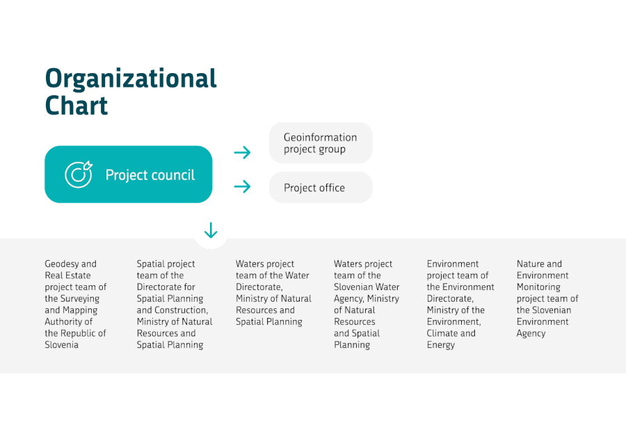
Project Structure | Author Surveying and Mapping Authority
A solution to Slovenia’s development challenges in spatial planning, water, the environment, and real estate
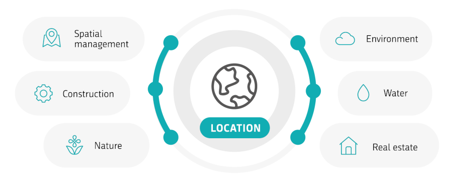
This project addresses challenges that (sub)urban sprawl and disparate construction practices have led to in recent decades. Its digitalization of spatial management, water, nature and the environment, and real estate, bolstered by environmental protection, help it plan the use of modern locational services to support the flow of investment into the spaces that need it.
Objective: Horizontal Digital Connection
Horizontally digitalizing spatial management, water, nature and the environment, and real estate will inform spatial management and the management of limited natural resources, ultimately leading towards fewer new buildings being constructed and thus increased resistance to climate change.
Author Surveying and Mapping Authority
Key Results Expected through 2026

Author Surveying and Mapping Authority
- Link critical digital infrastructure for spatial and environmental databases.
- Establish and facilitate access to digital databases and services.
- Foster an environment for locational and other services.
- Establish the fourth component of the National Coordinate System as the basis for digitalization and providing the missing data on state spatial and environmental data infrastructure (topography, Lidar, economic public infrastructure, floor plans, etc.).
Time Line
This project is planned for 3 phases:

Author Surveying and Mapping Authority
2021 – 2022
Putting organizational infrastructure in place, readying documentation, modernizing equipment. Drafting documents for establishing regional infrastructure to link state and municipal actors. Holding public tenders for digitalizing key databases.
2023 – 2024
Putting in place the first part of infrastructure and holding public tenders for supplementing the national spatial databases. Developing common codebooks, registers, and a draft model for the 4D national coordinate system. Holding public tenders for linking key IT systems, platforms, and services. Educating users.
2025 – 2026
Linking processes in spatial management, water, nature, and the environment. Establishing a working environment and developing services related to processes. Establishing a single platform and access point for the green and digital transformation in terms of spatial management. Launching a data visualization system. Linking state and local data infrastructure. Educating users.
The investment is included in the Slovenian plan, fundey by the Recovery and Resilience Plan.
Author Geodetska uprava
Author Geodetska uprava
Author Geodetska uprava
Author Geodetska uprava
Author Geodetska uprava